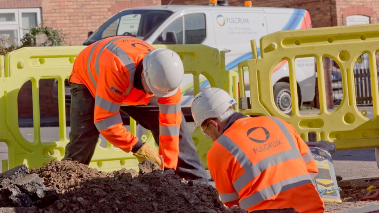
Excavation is a critical aspect of various construction and utility projects, but it is fraught with risks, particularly when it comes to encountering subsurface utilities. These can include water pipes, gas lines, telecommunications cables, and electrical conduits, often buried beneath the surface. Interfering with these utilities can lead to costly outages, project delays, injuries, or even fatalities. This is where subsurface utility locating comes into play. By accurately identifying the location of underground utilities, companies can perform safer and more efficient excavation work.
In this article, we delve into the importance of subsurface utility locating, explore the methods employed, and discuss best practices for ensuring safety during excavation activities.
Understanding Subsurface Utility Locating
Subsurface utility locating involves a series of techniques and technologies aimed at detecting and mapping the location of underground utilities. Accurate utility locating is foundational to safe excavation, as it provides essential information to construction crews regarding what lies below the surface. The practice not only minimizes risks but also enhances the overall efficiency of projects by reducing the likelihood of unexpected disruptions.
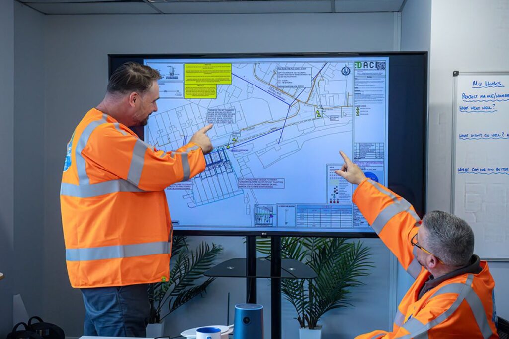
Utility locating is typically performed by skilled professionals using a combination of electromagnetic techniques, ground-penetrating radar (GPR), and other technological methods. The data gathered allows for the creation of maps or digital models that detail the locations of utilities in relation to the planned excavation site. This mapping is crucial, as it serves not only as a guide for current projects but also as a valuable resource for future construction endeavors, ensuring that utility information is readily accessible and up-to-date.
Types of Subsurface Utility Locating Techniques
There are various techniques employed in subsurface utility locating, each with its advantages and suitable applications. The two primary methods include electromagnetic locating and ground-penetrating radar (GPR).
Electromagnetic locating involves using electromagnetic fields to detect the presence of metal utilities. A transmitter sends signals along the utility lines, which are then picked up by a receiver, pinpointing their location. This method is particularly effective for locating metallic pipelines and cables. However, its effectiveness can be influenced by factors such as soil conductivity and the depth of the utilities, necessitating a thorough understanding of the local environment by the utility locating professionals.
Ground-penetrating radar, on the other hand, utilizes radar pulses to image the subsurface. This non-invasive method is effective for detecting utilities that may not be metallic, as it can identify various materials based on their dielectric properties. GPR can also uncover other features, such as voids or inconsistencies in the subsoil. The versatility of GPR makes it an invaluable tool in urban areas where multiple layers of utilities can exist, allowing for a comprehensive assessment of the subsurface landscape.
It’s essential for utility locating professionals to choose the appropriate method based on the specific conditions of the excavation site, including soil type and utility composition. Additionally, they must consider the project’s timeline and budget, as different techniques may vary in cost and time efficiency.
Benefits of Subsurface Utility Locating
The benefits of subsurface utility locating extend well beyond just safety. First and foremost, accurate utility locating helps prevent costly damage to underground utilities, which can result in repairs, emergency responses, and disruptions to services. Each of these factors can significantly impact project timelines and budgets. For instance, hitting a water main can not only lead to immediate repair costs but can also result in fines and penalties from local authorities, further complicating project management.
Moreover, by employing proper utility locating techniques, construction teams can work more efficiently. Knowing the precise locations of subsurface utilities allows for more targeted excavation, reducing unnecessary digging and minimizing the overall footprint of the work site. This can lead to time savings and decreased labor costs. In addition, efficient utility locating can contribute to sustainability efforts by reducing waste and limiting the environmental impact of construction activities.
Furthermore, effective subsurface utility locating fosters better communication among stakeholders, including construction crews, project managers, and utility providers. Clear understanding and documentation of utility locations can facilitate smoother project execution and promote collaboration across different trades. This collaborative approach can also enhance safety protocols, as all parties are informed about potential hazards, leading to a more cohesive and well-coordinated work environment. Ultimately, the integration of advanced utility locating techniques into construction planning not only streamlines operations but also elevates the standard of safety and efficiency in the industry.
Best Practices for Subsurface Utility Locating
To maximize the benefits of subsurface utility locating, several best practices should be adhered to. Firstly, project planners should conduct thorough site assessments, integrating utility locating into the initial planning phases of a project. This proactive approach will ensure that potential risks are addressed early on. By identifying existing utilities before excavation begins, teams can avoid costly delays and potential hazards that may arise from unanticipated encounters with underground infrastructure.
Secondly, it’s vital to engage qualified utility locating professionals who are trained and experienced in the latest techniques and technologies. This expertise is critical in ensuring accurate and reliable locating results, which are indispensable during the excavation process. Professionals equipped with the latest tools, such as electromagnetic locators and ground penetrating radar (GPR), can provide insights that significantly reduce the likelihood of damaging underground utilities, thereby enhancing safety and project efficiency.
Another important practice is to maintain open communication with utility providers. Establishing a solid relationship with local utility companies can enhance data accuracy, as these organizations may have valuable insights into the utilities lying beneath the surface. They can also provide maps of existing infrastructure that can aid in the locating process. Furthermore, utility companies often have historical data that can inform project planners about previous installations and any modifications made over time, which is crucial for accurate utility mapping.
Regulatory and Compliance Considerations
When performing subsurface utility locating, it is also crucial to adhere to local regulations and industry standards. Many regions have specific requirements regarding utility locating before excavation, often mandated by safety and environmental regulations. Compliance with these standards not only ensures legal adherence but also guarantees the safety of all parties involved. Additionally, understanding the legal landscape can help project managers navigate potential liabilities and ensure that all necessary permits are obtained prior to commencing work.
In addition, operators must conduct proper documentation of the locating process. Accurate records detailing utility locations and the methods used should be kept and shared with relevant stakeholders. This documentation serves as a reference for future projects and can aid in disputes or claims that may arise from utility-related incidents during excavation. Keeping a comprehensive log of the locating process, including photographs and maps, can also be beneficial for training new staff and improving future locating efforts.
Technological Innovations in Utility Locating
The field of subsurface utility locating is continually evolving with advances in technology. Recent innovations, such as augmented reality and advanced GPR systems, are increasingly being explored. These tools not only improve the accuracy and efficiency of utility locating but also enhance the visual representation of subsurface utilities for stakeholders. For instance, augmented reality can overlay digital information onto the physical world, allowing project teams to visualize underground utilities in real-time, which can significantly aid in decision-making during excavation.
Moreover, the integration of Geographic Information Systems (GIS) with utility locating practices allows for better mapping and data management. These digital tools enable the visualization of utility networks and can be tremendously useful in planning and executing excavation projects. By utilizing GIS technology, teams can analyze spatial relationships and assess the impact of proposed work on existing utilities, leading to more informed planning and reduced risk of utility strikes. Additionally, the ability to update GIS databases in real-time as new information becomes available ensures that all stakeholders have access to the most current utility data, fostering collaboration and enhancing project outcomes.
More to Read : The Role of a Construction Surveyor in Large-Scale Developments